.jpg)
Stand in southwest Iceland and you are standing on a boundary.
Not a political one.
Not a symbolic one.
But a planetary seam.
Beneath your feet, the tectonic plates Iceland sits upon are moving apart, slowly, relentlessly, at roughly two centimetres per year. It is the only place on Earth where you can walk along the exposed crest of the great Mid-Atlantic Ridge, the scar where continents are being torn from one another.
Welcome to the ultimate geological tug-of-war.
A Planet in Motion
The surface of our planet is broken into vast slabs known as tectonic plates. Iceland straddles two of them:
- The North American Plate to the west
- The Eurasian Plate to the east
These plates are drifting apart along the Mid-Atlantic Ridge, a colossal submarine mountain chain stretching from the Arctic to the Southern Ocean.
Most of that ridge lies hidden beneath kilometres of Atlantic water.
But in Iceland, it rises into the light.
Why Tectonic Plates in Iceland Are Visible
Usually, when plates pull apart beneath the ocean, magma wells up, cools, and quietly forms new oceanic crust on the seabed.
In Iceland, something extraordinary happens.
Here, the spreading ridge coincides with a deep mantle plume — an upwelling of unusually hot material rising from far below the Earth’s crust. This plume feeds extraordinary volumes of magma into the rift.
The result?
- More eruptions
- Thicker crust
- Land that rises above sea level
Instead of a hidden seam on the ocean floor, Iceland is the exposed spine of the Atlantic.
You are not just seeing plate tectonics.
You are standing inside it.
Pulling Apart — What It Actually Looks Like
When we talk about tectonic plates Iceland, we are not speaking metaphorically.
The crust physically fractures.
Across regions like Reykjanes Peninsula, long fissures slice through lava fields. Wide cracks open in the ground. Fault scarps drop metres in a single rifting event.
In Þingvellir National Park, visitors can walk between sheer rock walls marking the boundary between continents. The valley itself is a rift, a space being widened by geological force.
It is subtle in human time but in geological time, it is violent architecture.
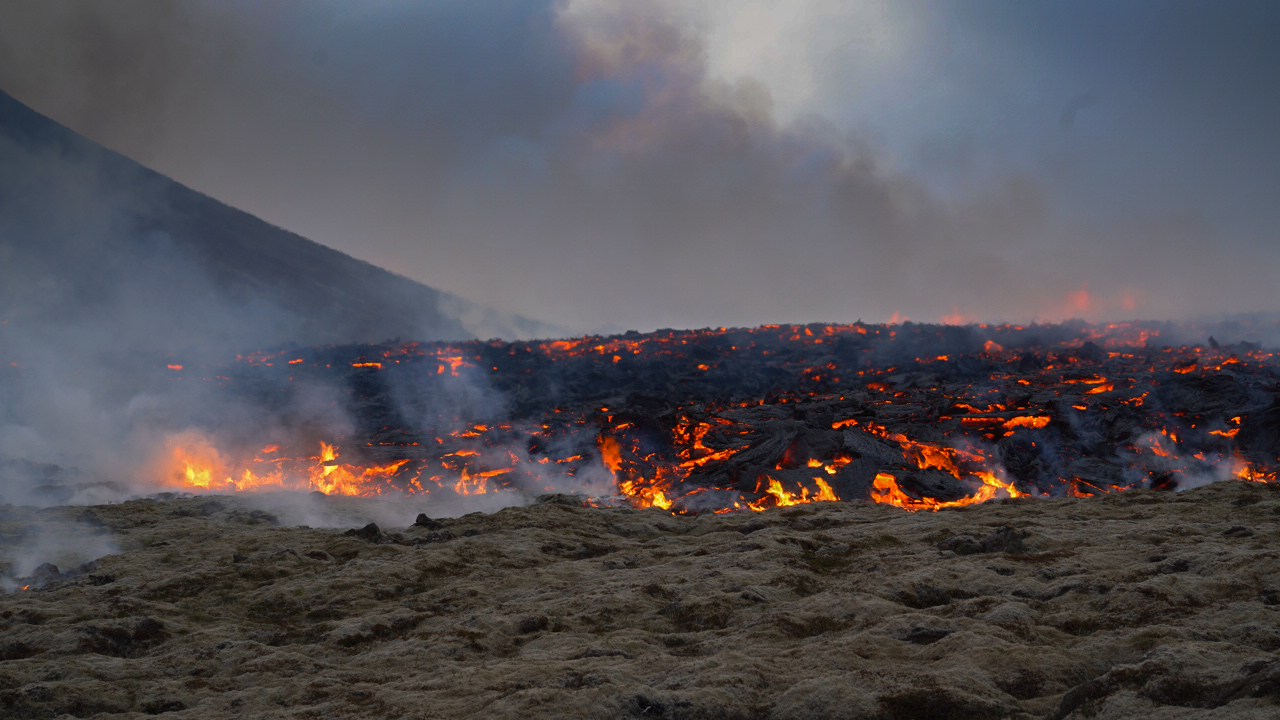
Fire Follows Fracture
Where the crust pulls apart, magma rises to fill the gap.
This is why Iceland experiences frequent volcanic eruptions. The rifting is not smooth, it happens in pulses. Periods of quiet strain build beneath the surface, then release in rifting episodes marked by:
- Earthquake swarms
- Ground deformation
- Fissure eruptions
Recent activity along the Reykjanes Peninsula has reminded the world that the tectonic plates beneath Iceland are anything but dormant.
Each eruption is part of the same planetary mechanism:
Crust tears → magma ascends → new land is born.
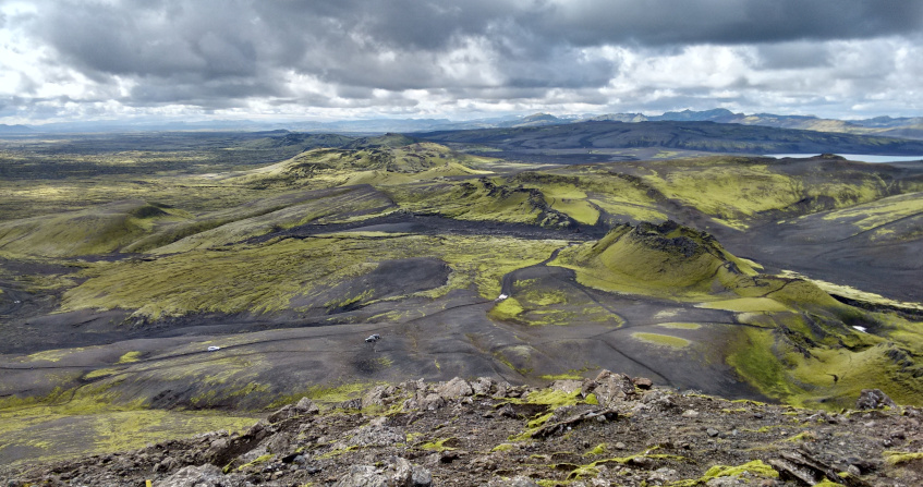
Iceland: A Living Geological Laboratory
Geologists often describe Iceland as a natural laboratory, the only place where we can observe the construction of oceanic crust above sea level.
The forces that shape 70% of Earth’s surface are visible here in raw form:
- Rift valleys widening
- Lava flows stacking layer upon layer
- Fault lines shifting landscapes
If Earth had a workshop, Iceland would be it.
The Long View
Two centimetres per year sounds trivial.
But stretch that over a million years, and Iceland widens by 20 kilometres.
The Atlantic Ocean itself was born from this process, beginning around 60–70 million years ago when continents began to split apart. Iceland sits directly atop that evolving boundary, a geological hinge between worlds.
It is young land, in Earth terms. Restless. Under construction.
What This Means for Volcano Express
When visitors enter Volcano Express, they are not watching a disaster story.
They are witnessing planetary creation.
The tectonic plates Iceland straddles are reshaping the island in real time. Every tremor, every eruption, every glowing river of lava is part of a deep-time narrative that began long before humanity and will continue long after.
This is not destruction.
It is Earth building itself.
And in Iceland, you can see it happen.


.jpg)